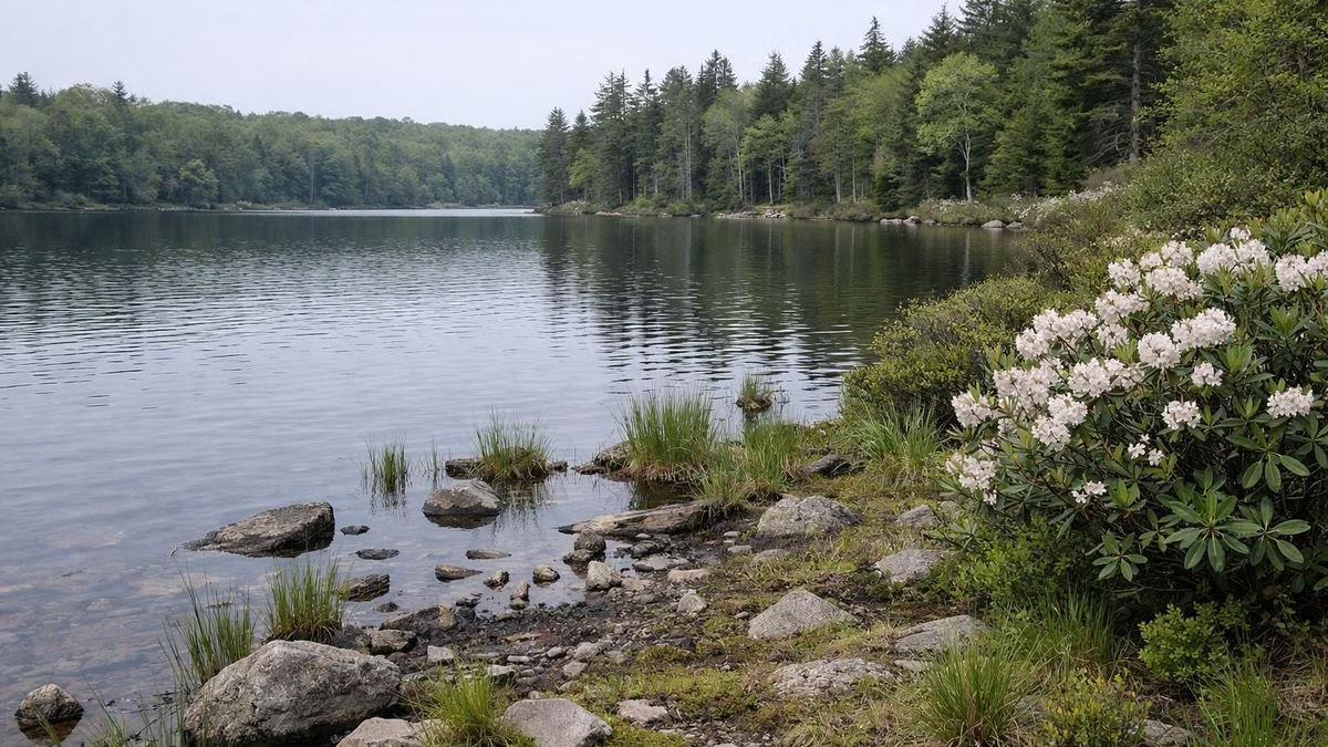
Promised Land State Park and the Delaware State Forest around it share about 50 miles of hiking trails, and most of the park's own trails are short, flat and rated Easiest by DCNR. The three hikes most visitors pick are the 1-mile loop around Conservation Island, the 1-mile Little Falls Trail past small waterfalls, and the 2.5-mile walk out to Bruce Lake, a natural glacial lake in the state forest. Designated trails carry vertical blue blazes, and numbered signs mark each junction.
Trail Finder
Every Park Trail, Side by Side
All 23 trails on DCNR's Promised Land hiking page, from the 5.8-mile Boundary Trail down to the 0.31-mile Conservation Island Trail. Tap a chip to show only the easy ones, the loops or the trails open to mountain bikes.
Showing all 23 marked trails. Dogs are allowed on every trail on a leash of 6 feet or less.
Names, miles, ratings, route types and permitted uses are from DCNR's Promised Land hiking page, read November 8, 2026. Miles are one way and are the full trail length where a trail runs on into Delaware State Forest; Bruce Lake Trail shows the 2.5 miles to the lake (DCNR gives 2.5 to 10). DCNR's Easiest shows here as Easy and More Difficult as Moderate. Loop means DCNR calls it a loop trail; out-and-back and connector trails show as one way. Bikes means DCNR lists mountain biking. DCNR gives no walking times, so that column is a dash. A dash means the source doesn't say; those trails drop out when you filter on that column.
Plan by Time
One Hour, Half a Day or a Full Day
Three routes built from DCNR's trail distances. DCNR publishes no hiking times, so pick by miles and your own pace.
Do the 5-mile round trip to Bruce Lake in the morning. Bruce Lake guide.
Drive to the Little Falls Trailhead (GPS 41.31430, -75.23504) and walk the 1.02-mile loop past the small falls on the East Branch of Wallenpaupack Creek. It is rated More Difficult: narrower, with rocks and roots. Little Falls guide.
Cross the footbridge about 0.25 mile in to come back down the other bank.
About 6 miles of walking in all, by DCNR's distances. Neither trailhead has restrooms or water. Save the park map before you go, since cell service is unreliable.
At a Glance
Hiking at a Glance
Trail milesAbout 50, park and state forest together
BlazesVertical blue blazes on designated trails
DifficultyMostly Easiest; Little Falls and Egypt Meadow More Difficult
Longest in the parkBoundary Trail, 5.8 miles
DogsAllowed leashed (6-foot leash maximum)
Bloom seasonLaurel and rhododendron, mid-May to mid-June
The Three Hikes to Start With
Conservation Island Loop (1.01 miles, Easiest)
A self-guided nature loop around the island in Promised Land Lake, with benches and lake views the whole way. A booklet from the park office explains the stops. Non-flush restrooms at the trailhead. Full guide: Conservation Island.
Little Falls Trail (1.02 miles, More Difficult)
A yellow-blazed loop beside the East Branch of Wallenpaupack Creek, named for its run of small falls. A footbridge a quarter mile in crosses the creek. Full guide: Little Falls Trail.
Bruce Lake Trail (2.5 miles each way to the lake)
An old Delaware State Forest road from the trailhead on PA 390 to Bruce Lake. It keeps going 7.5 more miles to meet Boundary Trail east of Promised Land Lake. Full guide: Bruce Lake.
Other Park Trails, by DCNR Distance
Boundary Trail, 5.8 miles, Easiest, out-and-back: follows the line between park and state forest from the south end of the park around to the north.
Rhododendron Trail, 2.2 miles, Easiest: links Pickerel Point Road and Burley Inlet Trail to the Day Use Area, and doubles as the bike-friendly route instead of PA 390. Mountain bikes allowed.
Big Dam Ridge Trail, 1.36 miles, Easiest: runs along the park edge between Bear Wallow and Mill Brook No. 1 trails, crossing a ford on the creek below Lower Lake Dam.
Bear Wallow Trail, 0.9 mile in the park (2.5 total): from the Bear Wallow Cabin Colony onto state forest trails.
Village Trail, 0.9 mile: from a lot on Lower Lake Road to the Village of Promised Land.
Burley Inlet Trail, 0.4 mile in the park (1.75 total): an old CCC fire road that passes the site of a 1930s fire tower and a deer exclosure.
Rock Oak Ridge Trail, 0.47 mile in the park (1.5 total): a CCC-built trail where the orienteering course begins.
Whittaker Trail, 0.18 mile in the park (0.55 total): rhododendron, laurel and blueberry under hardwoods, past old CCC borrow pits.
Egypt Meadow Trail, 0.75 mile, entirely on state forest land, More Difficult: an old woods road to the Egypt Meadow Lake spillway, a lake the CCC made in 1935.
Short connectors fill the gaps: 1800 Trail, Bald Eagle, Lower Lake, Mountain Laurel, Power Tower (from the park office), Red Oak (from Parking Lot 1), Snow Shanty and Tree Tower. DCNR's page gives each one's length and blaze.
Reading the Trail Signs
Designated recreational trails all use vertical blue blazes. At each junction a sign gives the trail name, the intersection number, permitted uses, emergency route and distances. DCNR says to ignore any other paint marks you see: they are not part of this trail system. The numbered intersections match the park map.
Difficulty, the DCNR Way
Easiest means a gentle grade and few obstacles. More Difficult means steeper, narrower tread with rocks and roots. Most Difficult means steep, physically hard and sometimes poorly marked; no trail inside the park carries that rating. Even Easiest trails here are rocky underfoot, because the plateau is covered in glacial boulders.
When to Hike
Mid-May to mid-June brings mountain laurel and rhododendron into bloom along the trails. Blueberries ripen in late July, and leaf color typically peaks in early October. In hunting season, wear fluorescent orange and check which areas are open to hunting.
Before You Go
Let someone know your route and your return time.
Carry a map and stay on marked trails; plan to be out before dusk.
Wear sturdy footwear for rock and root.
Keep dogs leashed (6-foot leash maximum).
Motorized vehicles are banned on hiking trails, except snowmobiles on designated routes in winter.
Good For
Families wanting short, mostly flat lake walks.
Anyone after a waterfall or a wild glacial lake within a morning's walk.
Maybe Skip If
You want a summit or big views: the plateau is gently rolling, so see Delaware State Forest for longer routes.
You want paved paths: only the park roads are paved. See Biking.
FAQ
Hiking FAQ
How much trail is there at Promised Land State Park?
About 50 miles, counting the park and the surrounding Delaware State Forest. The longest trail inside the park is Boundary Trail at 5.8 miles.
What is the best hike at Promised Land State Park?
For most visitors, the 1-mile Conservation Island Loop or the 1-mile Little Falls Trail. For a longer outing, walk 2.5 miles to Bruce Lake.
Are the trails at Promised Land hard?
Most are rated Easiest by DCNR. Little Falls and Egypt Meadow are More Difficult, and every trail is rocky underfoot.