Plan Your Visit
Know Before You Go
- HoursSunrise to sunsetEvery day of the year; day-use areas close at dusk
- EntryFreeNo entrance or day-use fee at any Pennsylvania state park
- Pets6-foot leashAllowed on trails on a leash of 6 feet or less
- Cell serviceUnpredictableDownload the park map before you go
- Address100 Lower Lake RoadGreentown, PA 18426, on PA Route 390
Promised Land State Park is a lake-and-forest park in the Pocono Mountains, so most visits revolve around the water: swimming at one of two sand beaches, renting a rowboat or kayak, and walking short trails along the shore. A first visit usually covers the Day Use Area on Promised Land Lake, the loop around Conservation Island and the waterfalls on Little Falls Trail. Entry costs nothing, and the gates stay open from sunrise to sunset daily.
Planning at a Glance
A Good First Day
- Park at the Day Use Area on PA 390 and walk down to the main beach.
- Rent a rowboat, canoe or kayak from the boat concession for an hour on Promised Land Lake. Only electric motors run here, so the water stays quiet.
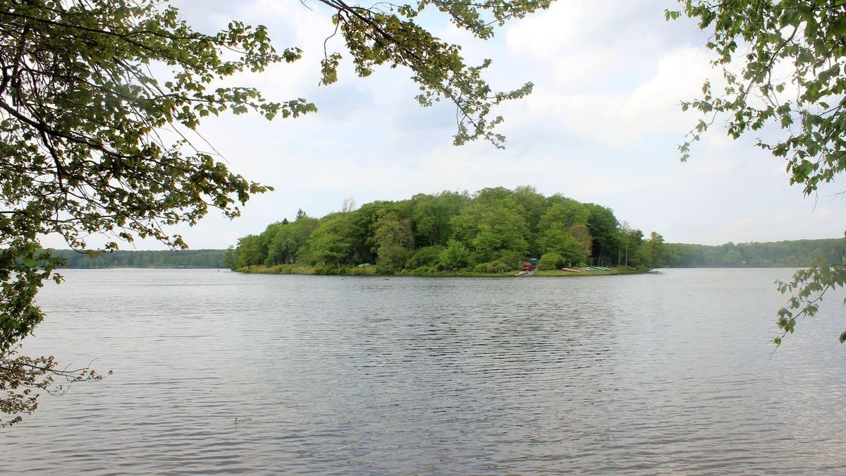
- Drive or walk to Conservation Island and take the 1-mile loop, with benches looking out over the lake.
- Finish at Little Falls Trail, a 1-mile loop past small falls on the East Branch of Wallenpaupack Creek.
If You Have a Weekend
Stay in a 1930s CCC cabin by Lower Lake, a campsite on the Pickerel Point peninsula or one of the new glamping tents. Spend a morning on the hike to Bruce Lake, a natural glacial lake in the surrounding state forest, and an afternoon at the free Masker Museum, which tells the Civilian Conservation Corps story.
Picnicking
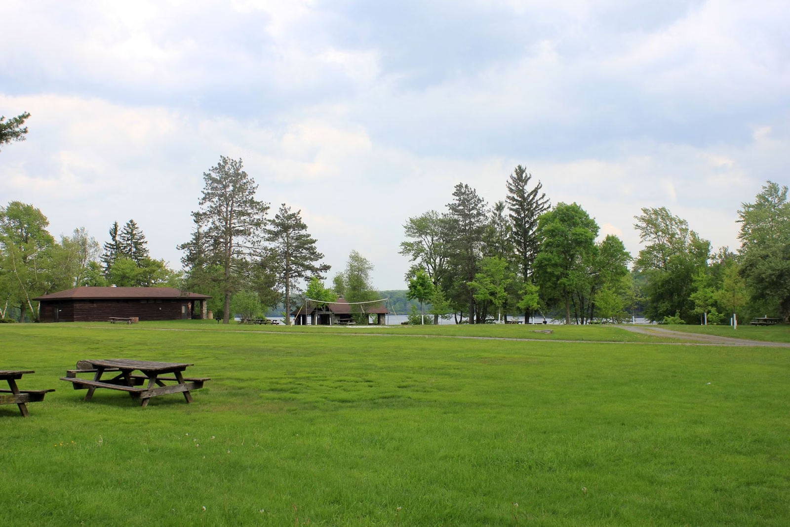
The Day Use Picnic Area sits in the woods beside Promised Land Lake, a short walk from the main beach, boat rental and refreshment stand. It has parking, a playground, drinking water, restrooms, trash containers, a sand volleyball court and a basketball hoop. Two pavilions rent for a fee as far as 11 months out; unbooked pavilions are free to whoever gets there first. Falls Pavilion is ADA accessible, seats up to 64 at eight tables and allows pets.
Borrow Gear From the Office
The park office lends binoculars, snowshoes, fishing poles and tackle, and compasses. Pick up a compass and the course brochure for the compass course that starts at the Rock Oak Ridge Trailhead near the Pines Campground, or ask for the brochure for the virtual geocache trail on CCC history.
Programs
Rangers and educators run guided hikes, hands-on sessions and special events from April through October, several times a week in summer. School and group programs book through the park office, ideally three months ahead. Check the DCNR events calendar for dates.
When to Come
Mountain laurel and rhododendron bloom from mid-May to mid-June, blueberries ripen in late July, and fall color usually peaks in early October. Summer weekends are the busiest time at the beach and boat rental. See Weather & Seasons for each month.
What to Bring
- The park map, downloaded, because cell signal is patchy.
- Bug spray and sturdy shoes for rocky, rooty trails.
- Linens and cooking gear if you rent a cabin or cottage.
- Fluorescent orange in hunting season if you hike. See Hunting.
Month by Month: Weather and Seasons
Typical highs, lows, rain and snow for each month, with the beach, campground and winter seasons DCNR lists.
Best time: June through August, when both beaches and every seasonal campground are open and normal highs run 77 to 81°F. In winter the park stays open, with snowshoeing, ice fishing and snowmobile trails, and Pickerel Point keeps a few campsites and the camping cottages open year round.
| Month | High / Low | What's Open & On |
|---|---|---|
| Jan | 33° / 14°3.2" precip · 13" snow |
|
| Feb | 36° / 14°2.7" precip · 13.2" snow |
|
| Mar | 45° / 22°3.5" precip · 9.4" snow |
|
| Apr | 58° / 32°3.7" precip · 1.1" snow |
|
| May | 69° / 43°3.6" precip |
|
| JunBest | 77° / 53°4.7" precip |
|
| JulBest | 81° / 57°4" precip |
|
| AugBest | 79° / 55°4.1" precip |
|
| Sep | 73° / 48°4.3" precip |
|
| Oct | 61° / 36°4.4" precip |
|
| Nov | 49° / 27°3.2" precip · 1.3" snow |
|
| Dec | 38° / 20°3.6" precip · 9.1" snow |
|
Sources: NOAA NCEI 1991–2020 normals (Hawley 1 E, PA, the nearest station with temperature, rain and snow normals), public domain; DCNR, Promised Land State Park: Stay the Night; DCNR, Promised Land State Park: Swimming; DCNR, Promised Land State Park: Winter Recreation; DCNR, Promised Land State Park. Temperatures are 30-year averages, not a forecast. Temperatures come from Hawley, about 900 feet lower than the park, so the plateau can run cooler. Seasons are in DCNR's own words ("early April", "mid-October"); call the park office at 570-676-3428 for this year's exact dates. No DCNR page says which months draw the crowds, so none are shown. Gold marks are our pick, not a DCNR rating.
Plan Your Visit FAQ
What is there to do at Promised Land State Park?
Swimming at two sand beaches, boating on two electric-motor-only lakes, fishing, about 50 miles of trails with the state forest, camping, CCC cabins and the free Masker Museum.
Is Promised Land State Park worth visiting?
For lakes and quiet woods, yes. It has two lakes, an island loop trail, small waterfalls and a nesting pair of bald eagles, with no entrance fee.
Can you rent kayaks at Promised Land State Park?
Yes. The boat concession rents rowboats, canoes, one- and two-person kayaks and paddleboats in summer, and electric motors too.
Are there picnic pavilions at Promised Land?
Yes, two in the Day Use Picnic Area. Book one for a fee as far as 11 months out, or use it free if no one has.
Facts from the DCNR page for Promised Land State Park.